basstacle4see
New member
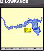
I just finished the first Lowrance map for Maguga. The map overlay had 10m contour intervals. I found that Google earth was out by up to 20 meters in places. Some areas were logged by Dr Depth and included in the map
Check out http://www.fishtec.co.za
Check out http://www.fishtec.co.za