When I started targeting bigger bass in deeper water, I must confess that all I was doing was driving around dragging a big crankbait behind the boat and hoping that #1, I find a big fish, and #2, I don’t lose my expensive lure. Every now and again I got lucky and found the odd 2-3kg fish.
My sonar / ‘fishfinder’ (Navman Fish400 bottom of the range) became a very important tool to me because depending on what lure I was pulling, there was a certain depth contour that I had to try follow. Picking up trees in advance also helped me not lose so many lures. Very often some of my better fish were caught soon after lightly bumping into these trees. So knowing as much as possible about these trees became just as important as the depth contour. This forced me to improve on my ‘underwater vision’, and I bought an Eagle TriFinder. Trees became so much easier to spot, and with the tri-finder transducer, I could tell if the structure / fish were below the boat, slightly to port or starboard. It was fantastic, and I started getting a little ‘luckier’ immediately, resulting in my first >4kg bass.
Then disaster struck … my wife hooked into a 4.5kg which was 200g bigger than my PB! Something had to be done about this, and I realized that my biggest downfall was memory, I just couldn’t remember all the spots. This resulted in a lack of repeatability, so a GPS came into play, a handheld Magellan 315. The collection of waypoints and starting of a fishing log began. I couldn’t believe my luck, those big fish started rolling in on a regular basis now.
As time went on I kept upgrading my ‘vision’ (sonar) and ‘memory’ (GPS/Log Book). The only enemy I had now was time. There just wasn’t enough time in a day / weekend to fish and study ‘what lies beneath’. This was solved when I bought my first sonar logging device – the Eagle FishElite 640c. I could now record my entire day, and in the comfort of my home, take as much time as I wanted to study and record waypoints of drop offs, brushpiles, timber, rock piles etc. etc. By now I realized that luck was playing a much smaller role in landing these bigger fish than ever before.
Then a friend of mine allowed me to study his sediment map of one of my primary dams. I soon realized that certain areas that had key topographic structure such as funnel points and nearby dropoffs I had never seen on my sonar before had produced a lot of my better fish. But how do you get this massive map on your boat and somehow fish it accurately? Using Google Earth and image overlays of these sediment maps allowed me to create waypoints and routes that I could then save onto my GPS.
Then I discovered SI or ‘Side Imaging’ … I felt that as a so-called high-tec angler, (and various other names) we had reached the summit of our quest. We now had full colour 2D high resolution (vertical pixels), GPS waypoints, 2 dimensional topo maps, and now 3D like imagery of structure on the bottom! But I was wrong, something was still missing, and this is the biggest part of any bass angler’s pre-tournament planning, even if you fish the shallows* only … 3D Bathymetry.
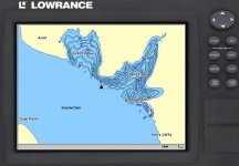
Bathymetry uses longitude, latitude and depth to create 3 dimensional orbit able digital models of the bottom of our dams and oceans. *The reason I say it applies to the shallows as well, is because bass use ‘highways’ (funnel points, old roads, ridges etc) to and from their ‘kitchen’ (shallows) to their ‘living rooms’ (deeper drop offs and structure). So if you have caught good fish in the shallows of a certain area, you can now use bathymetry to make a well informed guess as to where they came from and how they got there. This you can now repeat at other similar areas of the dam. These bathymetric images can also be converted into accurate super fine detailed 2D background maps that can be uploaded to your on-board system. Your old and new waypoints, trails and routes just become an overlay to these awesome background maps.
So now we have 3D bathymetry, 3D structure viewing and 2D bottom type / structure viewing … could there possibly be anything more?
Yes, there is! You need to find the fish in order to fish the fish without scaring them off. And how do we do that? With High Definition Broadband Sonar by Lowrance. (that really came across as a sales pitch of note – but it’s true) You now have technology available that allows you to interpret with great stealth, accuracy and target separation i.e. what’s a rock, a log or most importantly ….. FISH! Being able to cover nearly a 60º area below your transducer, with the same clarity as 200kHz on the old technology systems without annoying the fish, is a HUGE benefit.
Over the last few years I have managed to put myself and others onto more than 40 bass over 4kg’s, 6 over 5kg’s and one over 6kg’s, using my electronics.
Don’t fight technology ………….. Embrace it! (You’ll find yourself getting a lot ‘luckier’ on every trip)
My sonar / ‘fishfinder’ (Navman Fish400 bottom of the range) became a very important tool to me because depending on what lure I was pulling, there was a certain depth contour that I had to try follow. Picking up trees in advance also helped me not lose so many lures. Very often some of my better fish were caught soon after lightly bumping into these trees. So knowing as much as possible about these trees became just as important as the depth contour. This forced me to improve on my ‘underwater vision’, and I bought an Eagle TriFinder. Trees became so much easier to spot, and with the tri-finder transducer, I could tell if the structure / fish were below the boat, slightly to port or starboard. It was fantastic, and I started getting a little ‘luckier’ immediately, resulting in my first >4kg bass.
Then disaster struck … my wife hooked into a 4.5kg which was 200g bigger than my PB! Something had to be done about this, and I realized that my biggest downfall was memory, I just couldn’t remember all the spots. This resulted in a lack of repeatability, so a GPS came into play, a handheld Magellan 315. The collection of waypoints and starting of a fishing log began. I couldn’t believe my luck, those big fish started rolling in on a regular basis now.
As time went on I kept upgrading my ‘vision’ (sonar) and ‘memory’ (GPS/Log Book). The only enemy I had now was time. There just wasn’t enough time in a day / weekend to fish and study ‘what lies beneath’. This was solved when I bought my first sonar logging device – the Eagle FishElite 640c. I could now record my entire day, and in the comfort of my home, take as much time as I wanted to study and record waypoints of drop offs, brushpiles, timber, rock piles etc. etc. By now I realized that luck was playing a much smaller role in landing these bigger fish than ever before.
Then a friend of mine allowed me to study his sediment map of one of my primary dams. I soon realized that certain areas that had key topographic structure such as funnel points and nearby dropoffs I had never seen on my sonar before had produced a lot of my better fish. But how do you get this massive map on your boat and somehow fish it accurately? Using Google Earth and image overlays of these sediment maps allowed me to create waypoints and routes that I could then save onto my GPS.
Then I discovered SI or ‘Side Imaging’ … I felt that as a so-called high-tec angler, (and various other names) we had reached the summit of our quest. We now had full colour 2D high resolution (vertical pixels), GPS waypoints, 2 dimensional topo maps, and now 3D like imagery of structure on the bottom! But I was wrong, something was still missing, and this is the biggest part of any bass angler’s pre-tournament planning, even if you fish the shallows* only … 3D Bathymetry.
Bathymetry uses longitude, latitude and depth to create 3 dimensional orbit able digital models of the bottom of our dams and oceans. *The reason I say it applies to the shallows as well, is because bass use ‘highways’ (funnel points, old roads, ridges etc) to and from their ‘kitchen’ (shallows) to their ‘living rooms’ (deeper drop offs and structure). So if you have caught good fish in the shallows of a certain area, you can now use bathymetry to make a well informed guess as to where they came from and how they got there. This you can now repeat at other similar areas of the dam. These bathymetric images can also be converted into accurate super fine detailed 2D background maps that can be uploaded to your on-board system. Your old and new waypoints, trails and routes just become an overlay to these awesome background maps.
So now we have 3D bathymetry, 3D structure viewing and 2D bottom type / structure viewing … could there possibly be anything more?
Yes, there is! You need to find the fish in order to fish the fish without scaring them off. And how do we do that? With High Definition Broadband Sonar by Lowrance. (that really came across as a sales pitch of note – but it’s true) You now have technology available that allows you to interpret with great stealth, accuracy and target separation i.e. what’s a rock, a log or most importantly ….. FISH! Being able to cover nearly a 60º area below your transducer, with the same clarity as 200kHz on the old technology systems without annoying the fish, is a HUGE benefit.
Over the last few years I have managed to put myself and others onto more than 40 bass over 4kg’s, 6 over 5kg’s and one over 6kg’s, using my electronics.
Don’t fight technology ………….. Embrace it! (You’ll find yourself getting a lot ‘luckier’ on every trip)